
Research
How do changes in the water cycle affect biodiversity? What information do we need to identify threatened ecosystems at an early stage? And how can artificial intelligence help us translate scientific findings into concrete conservation measures?
BioWaWi-AI takes an interdisciplinary research approach that combines an understanding of natural processes, model development, and practical application. The focus is on five research questions.
How do meteorological conditions, soil properties, groundwater, and land use influence water availability and, consequently, the biodiversity of different habitats?
Water availability is a critical habitat factor for many plant and animal species. However, it depends not only on precipitation but also on the water-holding capacity of the soil, topography, vegetation, and the interactions between soil and groundwater.
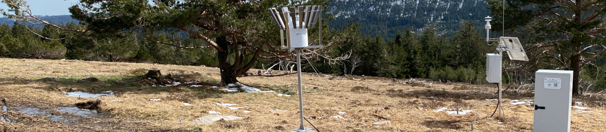
BioWaWi-KI investigates these relationships using an extensive environmental monitoring network and detailed studies at selected intensive monitoring sites. In particular, the project examines the spatial and temporal dynamics of soil moisture—ranging from small-scale differences in the root zone to the water balance of entire watersheds. The measurements are integrated with pedological analyses as well as floristic and faunistic surveys.
Particular emphasis is placed on moisture-dependent biotopes and indicator species, whose occurrence and development allow conclusions to be drawn about changes in the water balance. The target is to identify the key environmental factors and interactions that determine the stability of sensitive habitats.
Can critical changes in the water balance and vegetation be detected before they lead to a permanent loss of species and habitats?
Drought stress often develops gradually. While short-term changes in soil moisture are already measurable, effects on vegetation or species composition sometimes do not become apparent until much later. BioWaWi-KI is therefore investigating which measurable environmental changes can serve as early indicators of threats to biotopes and species.
To this end, continuous soil moisture and climate measurements are combined with vegetation surveys, automated imagery, and satellite-based vegetation indices such as the Normalized Difference Vegetation Index (NDVI). With the help of AI, the project aims, for example, to investigate whether changes in vegetation structure, species composition, or seasonal vegetation development can be linked to water availability.
Based on this, the project aims to identify critical thresholds and characteristic patterns that indicate increasing drought stress. The long-term target is an AI-supported early-warning system that identifies at-risk habitats and species as early as possible, thereby facilitating timely conservation measures.
How can AI methods use spot measurements, time series, photographs, and satellite data to generate the most comprehensive picture possible of the state of the environment?
Research on ecosystems poses unique challenges for data analysis. While weather stations and soil moisture sensors provide continuous measurements at individual locations, satellites cover larger areas but with different temporal and spatial resolutions. Added to this are species surveys, habitat maps, and photographs, which in turn contain very different types of information.
BioWaWi-AI investigates how these heterogeneous and, in some cases, incomplete datasets can be linked together using modern AI methods. A key focus is on the spatial and temporal interpolation of environmental parameters, particularly soil moisture. The research explores the extent to which AI can derive reliable conclusions about areas not directly studied based on available measurements and additional site information.
The automated analysis of image data also plays an important role. The research examines whether changes in vegetation and habitat condition can be quantified using recurring photographs and remote sensing data.
Another research question concerns the optimization of future monitoring strategies: Which environmental parameters must be recorded at what spatial and temporal resolution so that AI models can deliver the most reliable results possible?
Text Heading
How can we predict the impacts of climate change, land-use changes, and water management measures on the water cycle and biodiversity?
Building on the understanding of these processes, existing physics-based water balance and groundwater models are being further developed and integrated with AI methods. Among other things, the process models describe groundwater flow, groundwater recharge, and water transport in the soil. AI is intended to help identify complex relationships in the available environmental data and accelerate the calculation of different scenarios.
A central research approach involves so-called “what-if” scenarios. In these scenarios, specific influencing factors are deliberately altered to investigate their potential impacts on the water cycle and the living conditions of sensitive species and biotopes.
For example, the goal is to assess how prolonged dry spells, changes in groundwater levels, forestry interventions, or targeted irrigation measures could affect water availability. There is particular potential in supplementing complex numerical simulations with AI-based surrogate models to enable faster comparisons of different scenarios and courses of action.
The target is to develop scientifically sound forecasts and to be able to assess the potential consequences of environmental changes in advance.
How can AI-based forecasts and scientific findings be translated into effective measures for the management of water protection areas?
The methods developed are intended not only to provide new scientific insights but also to be applicable in water management practice. In collaboration with Stadtwerke Bühl, we are investigating how monitoring data, model calculations, and AI-based forecasts can be integrated into an early-warning and decision-support system.
A key component is the establishment of a digital control center that provides current environmental measurements and, in the future, model and forecast results for the assessment of water protection areas. Based on this, recommendations for action will be developed—for example, to protect biotopes that are particularly vulnerable to drought or to evaluate potential adaptation measures.
Regional stakeholders, government agencies, schools, and the public will also be involved in the project. Their experiences, requirements, and perspectives will help to present scientific findings in an accessible manner and develop practical measures.
Another target is to integrate suitable results into Stadtwerke Bühl’s environmental management system in accordance with ISO 14001. At the same time, the project will examine under what conditions the developed methods and concepts can be applied to other water protection areas.